

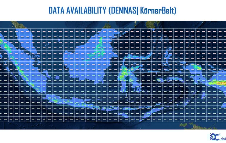
DEMNAS | Körner Bioclimatic Belts
PRODUCTSPATIAL MODELLINGNEW ARRIVAL
DEMNAS | Tropical Altitudinal Vegetation
This spatial dataset provides a comprehensive mapping of Altitudinal Vegetation Zones across Indonesia's mountainous regions. Modeled using high-resolution DEMNAS data from the Indonesian Geospatial Information Agency (BIG), this product adapts the bioclimatic nomenclature established by plant ecologist Prof. Christian Körner (Global Mountain Biodiversity Assessment) and refines it using local elevation thresholds characteristic of equatorial/Malesian mountain ecosystems (Johns, 1982; Hope, 2014).
In tropical landscapes, where temperature decreases steadily with altitude, ecological conditions shift predictably. This dataset captures those critical transitions by stratifying the terrain into distinct zones:
Colline/Lowland (0–800 m): Megathermal tropical lowland forests.
Sub-montane (800–1500 m): Transitional sub-montane forest zones.
Montane (1500–3000 m): High-humidity montane cloud forests.
Subalpine (3000–3500 m): The upper limits of tree lifeforms (climatic treeline).
Alpine (3500–4500 m): Treeless alpine grasslands and dwarf shrublands.
Nival (>4500 m): Bare rock and glacier zones (unique to New Guinea’s highest peaks).
This approach provides scientists and spatial planners with a robust GIS layer to detect climate-driven ecological shifts, evaluate mountain biodiversity vulnerability, and guide adaptive conservation strategies in tropical regions.
References / Citations :
Körner, C., Paulsen, J., & Spehn, E. M. (2011). A definition of mountains and their bioclimatic belts for global comparisons of biodiversity data. Alpine Botany, 121, 73–78.
Johns, R. J. (1982). Plant Zonation on Tropical Mountains. In: Gressitt, J.L. (eds) Biogeography and Ecology of New Guinea. Monographiae Biologicae, vol 42. Springer, The Hague.
Hope, G. (2014). The Sensitivity of the High Mountain Ecosystems of New Guinea to Climatic Change and Anthropogenic Impact. Arctic, Antarctic, and Alpine Research, 46(4), 777-786.
Data Source :
Name: DEMNAS
Publisher: BIG (Badan Informasi Geospasial)
Version: 2018 (latest version may vary)
Spatial Resolution : 0.27 arc-second (~8.25 meters at the equator)
File Format GeoTIFF
© 2025. All rights reserved.


LOCATION
East Kalimantan,Indonesia