
Spatial Dataset


Discover the abundance and variety of our natural world by exploring spatial dataversity.
Spatial Modeling
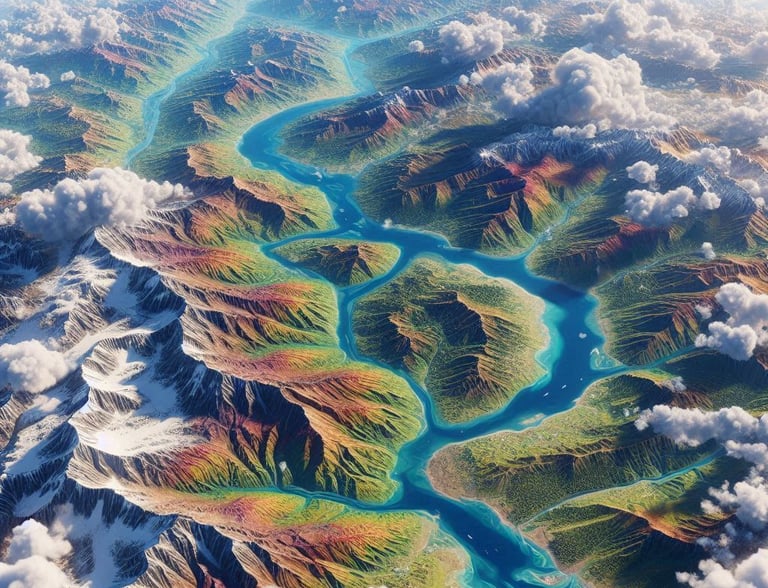
Digital Elevation Model (DEM)
Image Processing
Digital Elevation Model (DEM) is a representation of the Earth's surface that captures terrain elevation data in a digital format. DEMs are primarily derived from satellite imagery (such as Tandem X, ASTER GDEM,etc), aerial photogrammetry, LiDAR scans, and topographic surveys. These models play a crucial role in applications like hydrology, land-use planning, disaster management, and environmental monitoring.
Multispectral imaging systems typically capture data in multiple discrete spectral bands, ranging from visible light (red, green, and blue) to near-infrared (NIR) and shortwave infrared (SWIR). These systems are mounted on satellites, drones, and aircraft, and they utilize specialized sensors to differentiate materials based on their reflectance properties. The number of bands varies depending on the application, with common sensors using 4 to 10 bands.
Satellite image processing involves analyzing multispectral and hyperspectral images to extract valuable information about land cover, vegetation health, and urban expansion. Techniques like NDVI ,NDBI, NDWI, SAVI ,etc. provide specialized insights into environmental conditions.
Spatial modeling is a powerful analytical tool used to represent and simulate real-world geographic patterns, helping experts assess risks and make informed, data-driven decisions. By integrating spatial data from sources like satellite imagery, GIS databases, and sensor networks, spatial modeling enables precise analysis of environmental hazards, urban planning, and infrastructure development
Multi-spectral Image
Mindmap Assets
Let’s connect the dots and shape our own knowledge constellation


Laws & Regulations

Public Documents
Technical Guidance
© 2025. All rights reserved.


LOCATION
East Kalimantan,Indonesia