

DEMNAS | National DEM
PRODUCTDEM
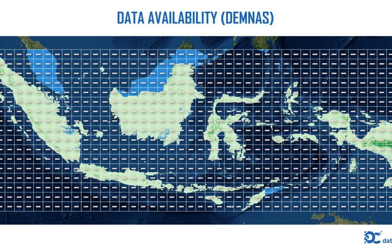
DEMNAS | National DEM
Provider: Badan Informasi Geospasial (BIG), Indonesia
Release Year: 2018 (latest version may vary)
Purpose: Standardized national-scale elevation model for geospatial analysis, development planning, and disaster mitigation
Specification
Coverage Area : Entire land area of Indonesia (excluding small offshore islands < 5 ha)
Spatial Resolution : 0.27 arc-second (~8.25 meters at the equator)
Vertical Accuracy : ±1 meter (flat terrain), ±2–3 meters (hilly/mountainous areas)
Horizontal Datum : WGS 84 (EPSG:4326)
Vertical Datum : EGM2008 geoid
Elevation Units : Meters above mean sea level
Data Type : 16 bit signed integer
File Format : GeoTIFF
Tile Size : 1° x 1°
Source Data : Interferometric processing of ALOS PALSAR (L-band) data, SRTM and LiDAR (for selected areas)
Void Filling : Integrated using SRTM 1 arc-second and manual interpolation
Update Frequency : Periodic, subject to availability of new remote sensing data
Access / Licensing : Free and open via tanahair.indonesia.go.id
© 2025. All rights reserved.


LOCATION
East Kalimantan,Indonesia