

Aster GDEM
Providers: NASA (USA) & METI (Japan)
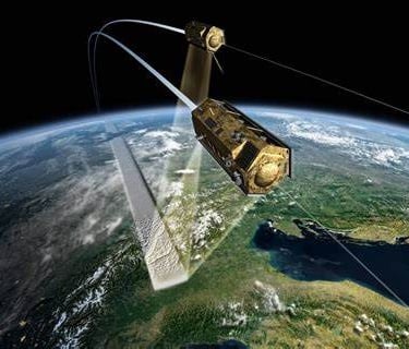
Mission Platform: Terra Satellite
Sensor: ASTER (Visible and Near-Infrared VNIR Sensor)
Release Version: Version 3 (latest, released in 2019)
Specification
Coverage Area : Global (83°N to 83°S) — nearly full land coverage
Spatial Resolution : 1 arc-second (~30 meters at the equator)
Vertical Accuracy : ±20 m (RMSE globally), varies by terrain and land cover
Horizontal Datum : WGS 84 (EPSG:4326)
Vertical Datum : EGM96 geoid
File Format : GeoTIFF
Tile Size : 1° x 1°
Elevation Units : Meters above mean sea level
Data Type : 16-bit signed integer
Data Source : Optical stereo imagery from ASTER VNIR nadir and backward-looking bands
Data Collection Period : 2000 – 2011 (GDEM V2), updated through 2019 (GDEM V3)
Void Filling: Interpolation using neighboring data and averaging from multiple scenes
Scenes per Pixel : Up to 30 stereo pairs used per location (V3), improving quality and reducing artifacts
Access / Licensing : Free and open access via NASA Earthdata or LP DAAC
© 2025. All rights reserved.


LOCATION
East Kalimantan,Indonesia