
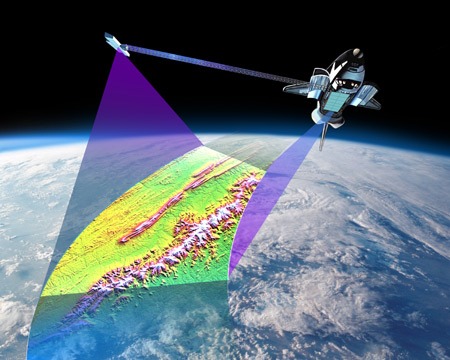
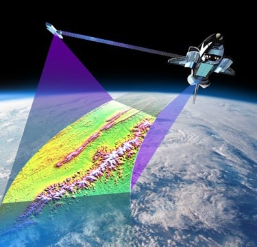
SRTM C Band (1 arc-second)
Free
Provider: NASA / USGS
Mission Date: February 11–22, 2000
Instrument: C-band Interferometric Synthetic Aperture Radar (InSAR)
Release: Public global access since 2014 (SRTMGL1 product)
Specification
Coverage Area : Nearly global: 60°N to 56°S (covers ~80% of Earth's land surface)
Spatial Resolution : 1 arc-second (~30 meters at the equator)
Vertical Accuracy : ±16 m (absolute), ±6 m (relative), varies by terrain/vegetation
Horizontal Datum : WGS 84 (EPSG:4326)
Vertical Datum : EGM96 geoid
File Format : GeoTIFF
Tile Size : 1° x 1°
Elevation Units : Meters above mean sea level
Data Type : 16-bit signed integer
Acquisition Method : Interferometric SAR via dual antennas on Shuttle Endeavour
Data Voids : Present in rugged terrain or dense vegetation; mostly filled in V3 release
Data Version : SRTMGL1 v3 (void-filled global release, 2014)
Access / Licensing : Public domain; downloadable via USGS EarthExplorer, NASADEM, or AWS Open Data
© 2025. All rights reserved.


LOCATION
East Kalimantan,Indonesia