
BATNAS | Benthic Zone
PRODUCTSPATIAL MODELLING
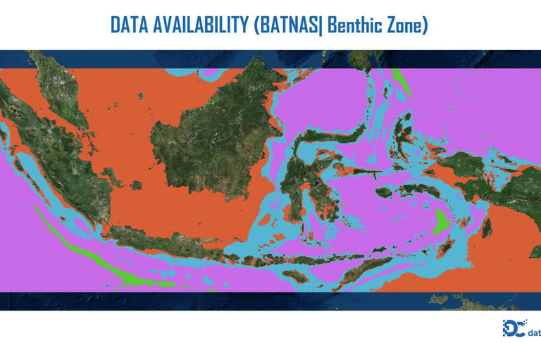
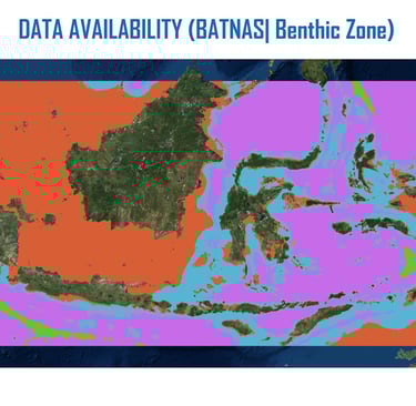
BATNAS | Benthic Zone
Level of Effort : Low
Data Source :
Name: BATNAS v.2.1
Publisher: BIG (Badan Informasi Geospasial)
First Released: 2014
Latest Version: BATNAS v2.1 (as of 2022)
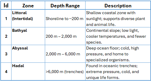
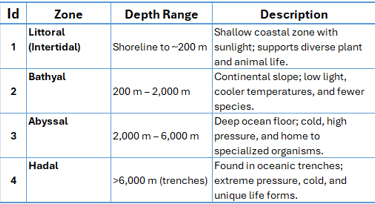
The benthic zone is the lowest ecological region in a body of water, including the ocean floor and sediment layers. It spans from shallow coastal areas to deep-sea trenches. Conditions vary from light and warm nearshore to dark, cold, and high-pressure in the deep. Organisms here, called benthos, include bacteria, worms, crustaceans, and sea stars. They play vital roles in nutrient cycling, decomposition, and supporting marine food webs. It's a key zone for biodiversity and ecosystem health.Classification of the benthic zone based on depth:
© 2025. All rights reserved.


LOCATION
East Kalimantan,Indonesia