
Technical Guidance
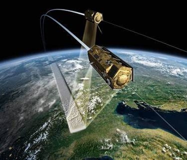
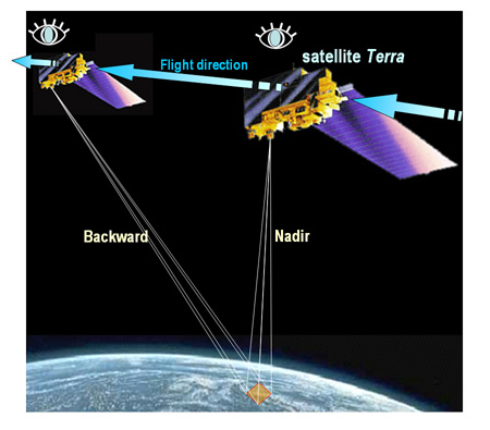
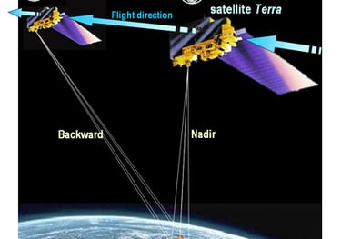
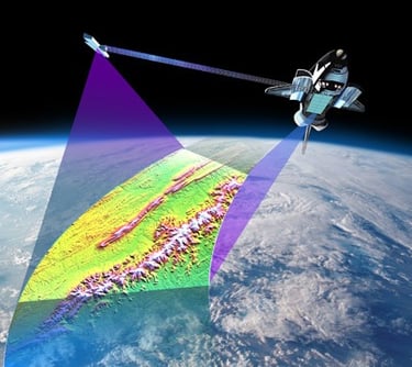
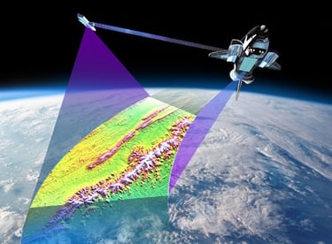
Digital Elevation Model (DEM) is a representation of the Earth's surface that captures terrain elevation data in a digital format. DEMs are primarily derived from satellite imagery (such as NASA’s SRTM and ASTER), aerial photogrammetry, LiDAR scans, and topographic surveys. These models play a crucial role in applications like hydrology, land-use planning, disaster management, and environmental monitoring.
Law & Regulations
Multispectral imaging systems typically capture data in multiple discrete spectral bands, ranging from visible light (red, green, and blue) to near-infrared (NIR) and shortwave infrared (SWIR). These systems are mounted on satellites, drones, and aircraft, and they utilize specialized sensors to differentiate materials based on their reflectance properties. The number of bands varies depending on the application, with common sensors using 4 to 10 bands.


Report/Public Documents
Digital Elevation Model (DEM) is a representation of the Earth's surface that captures terrain elevation data in a digital format. DEMs are primarily derived from satellite imagery (such as NASA’s SRTM and ASTER), aerial photogrammetry, LiDAR scans, and topographic surveys. These models play a crucial role in applications like hydrology, land-use planning, disaster management, and environmental monitoring.
© 2025. All rights reserved.


LOCATION
East Kalimantan,Indonesia